Collision avoidance
This example demonstrates how to use DepthAI to implement a collision avoidance system with the OAK-D camera. The script measures objects distance from the camera in real-time, displaying warnings based on predefined distance thresholds.
The script uses stereo cameras to calculate the distance of objects from the camera. The depth map is then aligned to center (color) camera in order to overlay the distance information on the color frame.
User-defined constants `WARNING` and `CRITICAL` are used to define distance thresholds for orange and red alerts respectively.
Similar examples
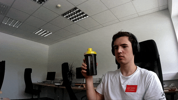
Demo
Setup
Please run the install script to download all required dependencies. Please note that this script must be ran from git context, so you have to download the depthai-python repository first and then run the script
git clone https://github.com/luxonis/depthai-python.git
cd depthai-python/examples
python3 install_requirements.py
For additional information, please follow installation guide
This example script requires external file(s) to run. If you are using:
depthai-python, run
python3 examples/install_requirements.pyto download required file(s)dephtai-core, required file(s) will get downloaded automatically when building the example
Source code
Also available on GitHub
1 2 3 4 5 6 7 8 9 10 11 12 13 14 15 16 17 18 19 20 21 22 23 24 25 26 27 28 29 30 31 32 33 34 35 36 37 38 39 40 41 42 43 44 45 46 47 48 49 50 51 52 53 54 55 56 57 58 59 60 61 62 63 64 65 66 67 68 69 70 71 72 73 74 75 76 77 78 79 80 81 82 83 84 85 86 87 88 89 90 91 92 93 94 95 96 97 98 99 100 101 102 103 104 105 106 107 108 109 110 111 112 113 114 | import depthai as dai
import cv2
import numpy as np
import math
# User-defined constants
WARNING = 500 # 50cm, orange
CRITICAL = 300 # 30cm, red
# Create pipeline
pipeline = dai.Pipeline()
# Color camera
camRgb = pipeline.create(dai.node.ColorCamera)
camRgb.setPreviewSize(300, 300)
camRgb.setInterleaved(False)
# Define source - stereo depth cameras
left = pipeline.create(dai.node.MonoCamera)
left.setResolution(dai.MonoCameraProperties.SensorResolution.THE_720_P)
left.setBoardSocket(dai.CameraBoardSocket.LEFT)
right = pipeline.create(dai.node.MonoCamera)
right.setResolution(dai.MonoCameraProperties.SensorResolution.THE_720_P)
right.setBoardSocket(dai.CameraBoardSocket.RIGHT)
# Create stereo depth node
stereo = pipeline.create(dai.node.StereoDepth)
stereo.setConfidenceThreshold(50)
stereo.setLeftRightCheck(True)
stereo.setExtendedDisparity(True)
# Linking
left.out.link(stereo.left)
right.out.link(stereo.right)
# Spatial location calculator configuration
slc = pipeline.create(dai.node.SpatialLocationCalculator)
for x in range(15):
for y in range(9):
config = dai.SpatialLocationCalculatorConfigData()
config.depthThresholds.lowerThreshold = 200
config.depthThresholds.upperThreshold = 10000
config.roi = dai.Rect(dai.Point2f((x+0.5)*0.0625, (y+0.5)*0.1), dai.Point2f((x+1.5)*0.0625, (y+1.5)*0.1))
config.calculationAlgorithm = dai.SpatialLocationCalculatorAlgorithm.MEDIAN
slc.initialConfig.addROI(config)
stereo.depth.link(slc.inputDepth)
stereo.setDepthAlign(dai.CameraBoardSocket.RGB)
# Create output
slcOut = pipeline.create(dai.node.XLinkOut)
slcOut.setStreamName('slc')
slc.out.link(slcOut.input)
colorOut = pipeline.create(dai.node.XLinkOut)
colorOut.setStreamName('color')
camRgb.video.link(colorOut.input)
# Connect to device and start pipeline
with dai.Device(pipeline) as device:
# Output queues will be used to get the color mono frames and spatial location data
qColor = device.getOutputQueue(name="color", maxSize=4, blocking=False)
qSlc = device.getOutputQueue(name="slc", maxSize=4, blocking=False)
fontType = cv2.FONT_HERSHEY_TRIPLEX
while True:
inColor = qColor.get() # Try to get a frame from the color camera
inSlc = qSlc.get() # Try to get spatial location data
if inColor is None:
print("No color camera data")
if inSlc is None:
print("No spatial location data")
colorFrame = None
if inColor is not None:
colorFrame = inColor.getCvFrame() # Fetch the frame from the color mono camera
if inSlc is not None and colorFrame is not None:
slc_data = inSlc.getSpatialLocations()
for depthData in slc_data:
roi = depthData.config.roi
roi = roi.denormalize(width=colorFrame.shape[1], height=colorFrame.shape[0])
xmin = int(roi.topLeft().x)
ymin = int(roi.topLeft().y)
xmax = int(roi.bottomRight().x)
ymax = int(roi.bottomRight().y)
coords = depthData.spatialCoordinates
distance = math.sqrt(coords.x ** 2 + coords.y ** 2 + coords.z ** 2)
if distance == 0: # Invalid
continue
# Determine color based on distance
if distance < CRITICAL:
color = (0, 0, 255) # Red
elif distance < WARNING:
color = (0, 140, 255) # Orange
else:
continue # Skip drawing for non-critical/non-warning distances
# Draw rectangle and distance text on the color frame
cv2.rectangle(colorFrame, (xmin, ymin), (xmax, ymax), color, thickness=2)
cv2.putText(colorFrame, "{:.1f}m".format(distance / 1000), (xmin + 10, ymin + 20), fontType, 0.5, color)
# Display the color frame
cv2.imshow('Left Mono Camera', colorFrame)
if cv2.waitKey(1) == ord('q'):
break
|